
Browse a Northfield Street
A Northfield street search works best as a record trail, not as a claim about everyone at an address. Start with the parcel that matches the house number. The Rice County property report identifies the assessed owner, the situs address, a mailing address, and the parcel identifier. That identifier and the legal description carry the search into deed records. Historic directories and local newspaper indexes can add a dated name-and-address clue, but they must be read as snapshots rather than proof of a current household.
Use the narrowest official source for each question. An assessed owner may receive tax mail somewhere else. A recorded deed identifies parties to a transfer. The state voter tool only confirms a single person who supplies the required identity details. Together, those limits keep the address search useful without turning it into a roster of people.
- Open Rice Beacon, select Property Search, and enter the modern address or parcel number.
- Save the parcel ID, situs address, assessed owner, mailing address, and legal description from the property report.
- Choose the Map tab, pan along the street, and identify one parcel polygon at a time for nearby property context.
- Search the current owner as grantee in Rice LandShark, then follow the recorded legal description and prior grantor.
- For an older person-at-address clue, consult Polk or phone directories, newspaper indexes, and the Pye Room rather than treating the current parcel report as a history.
Note: The individual Minnesota registration check is not a street roster and should only be used for its identity-bound confirmation purpose.
Northfield Beacon Street Search
Rice County’s official Beacon map instructions direct a searcher to Property Search, an address or parcel query, a selected result, and the Map tab. Beacon also supports owner-name searching. The owner route helps when an address has been confirmed elsewhere, but it does not establish that the owner lives at the parcel. If a report looks incomplete, retain the parcel number and ask the Assessor for the appropriate correction or access route.
| Beacon control | Street-directory use | Result or limit |
|---|---|---|
| Property Search | Official starting path | Enter an address or parcel number. |
| Address | Find the physical situs | Uses the current property address. |
| Parcel number | Bridge between systems | Helps when an address changes form. |
| Owner name | Find assessed-owner records | Try spelling variants; it is not an occupant search. |
| Map tab and polygon | Read a street segment | Opens map context and a selected property report. |
| Comparable Search | Compare properties | It is not a people list. |
Parcel reports can include value and property data, building sketches, pictures, and map context. Rice says Beacon has a report for every parcel and recorded 390,933 Beacon visits during 2024. Those features describe land and assessment records, not a full list of residents.
Northfield GIS Street Context
Beacon’s map tools turn an address into a street-segment view. Aerial imagery, two-foot contours, FEMA floodplain, bird’s-eye imagery, Pictometry, soils, and comparable-search tools provide location context. Click a polygon only after locating the target address, then pan or zoom and choose the next parcel individually. Rice has not documented a public control for an all-street result, a radius search, an owner export, or a resident-count layer.
Rice’s map guide shows the documented map workflow.
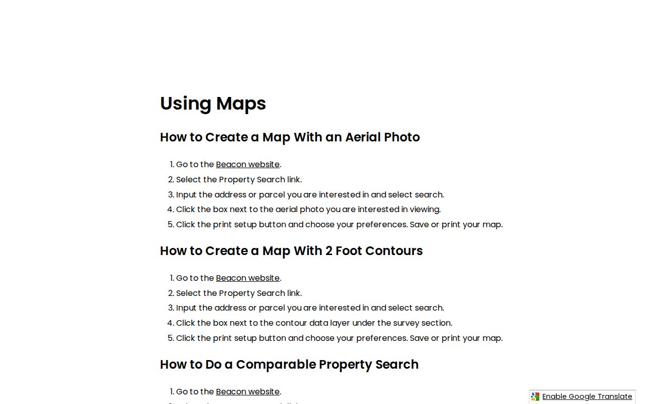
Use the pictured controls to find and identify a parcel, then preserve the report fields before moving to another address. The image does not show a bulk street directory result.
For municipal geography, the Northfield interactive maps add wards, precincts, historic imagery, zoning, flood context, sidewalks, trails, and Rice/Dakota reference layers. County Beacon is the ownership tool; the city map explains where the selected parcel sits in local geography.
Northfield Address Record Sets
Address-keyed sources do not all answer the same question. A parcel report ties an address to an assessed owner. A deed index explains a recorded transfer. A library volume may place an individual at an address in a particular publication year. City material can supply work or case evidence when a public portion is releasable. Keeping the search key beside the result avoids confusing a tax contact with a resident or a past directory listing with a current one.
| Address record | Best search key | What it can show | Access route |
|---|---|---|---|
| Beacon property report | Address, parcel, owner, map | Assessed owner, situs, mailing address, parcel details | Public online map |
| Recorder instrument | Grantor, grantee, tract, legal description | Recorded parties, dates, document locator | LandShark or Recorder counter |
| Plats and maps | Lot, block, subdivision | Street layout and a legal-property bridge | Recorder, library, city maps |
| Polk and phone volumes | Name, address, year | Historic address-to-name snapshot | Pye Room or historical society |
| Permits or code files | Address, date, category | Public work or case evidence where releasable | City Chapter 13 request |
Note: A parcel number is often the cleanest link between the property report, a plat, and a deed description.
Northfield Situs and Mailing Fields
Read the labels before saving an address. The situs or property address is where the parcel sits and is the key used to navigate the map. The owner mailing address is where assessment correspondence goes. It may be another local address, a business, a trust, or an out-of-state address. Neither field alone states who is physically present at the property.
A legal description, by contrast, identifies land through lot, block, subdivision, certificate-of-title, or metes-and-bounds wording. It is often more stable than a street number. That is why the Northfield street directory method saves the legal description before moving into recorded instruments.
- Parcel
- A county identifier for one assessed piece of property.
- Situs address
- The physical property address used to locate the parcel.
- Plat
- A recorded map that lays out lots, blocks, and subdivisions.
- Criss-cross directory
- A historic directory arranged to connect addresses and names for a stated publication period.
Northfield Deed Trails
After Beacon supplies the parcel and legal description, use LandShark to search the current owner as grantee around the likely transfer period. The grantor is the transferring party and the grantee is the receiving party. Capture the document type, recording date, document number or book/page locator, and legal description. Search the earlier owner as grantee for the same tract to continue a recorded chain.
Rice’s Recorder handles more than 300 record types. The county’s online-data information describes a remote LandShark route at $50 per month, $2 per document, and a $50 setup charge. Public record viewing at the Recorder counter is free, with ordinary copies listed at $1 per page. The Recorder is at 320 Third Street NW, Faribault, and can be reached at 507-332-6114.
The county describes the current digital index historically as 1987 forward, while more than 16,000 tract-book images from 1854 through the 1990s were digitized. An image span is not the same as a complete name index. A remote no-result therefore calls for a tract, legal-description, or counter check rather than a conclusion that no earlier record exists.
Northfield Plats and Parcels
Lots, blocks, and subdivisions keep an address search from drifting when a directory uses an older form of a street address. Recorder plats, Beacon’s parcel geometry, and historic maps can all supply that bridge. The Northfield Public Library holds local maps from 1855, 1869, and 1968, and its collection survey notes a 1910 Sanborn map in the Library Director’s Office. Ask staff for the map and plat indexes when a street name alone produces weak results.
The city’s Rice/Dakota maps also matter. Northfield crosses county geography, so an address, a postal label, and a city boundary should be checked against the record custodian that actually holds the parcel. The street directory remains strongest when it starts from a confirmed parcel rather than a broad city-name assumption.
Northfield Historic Address Sources
The Pye Room at Northfield Public Library is the local route for historical address evidence. Its materials include Northfield and Faribault phone books, Polk directories, newspaper microfilm, census microfilm, index cards, local and family histories, and files on people and buildings. Rice County Historical Society holds Polk directory runs, phone books, obituary scrapbooks, and local manuscripts. These sources can help date an address-to-name association without claiming it describes the present.
Directories sometimes preserve a useful sequence when a deed gives only parties and a legal description. Start with the year nearest the recorded transfer, note the printed address exactly, then move forward or back one available volume. The Northfield Directory Book provides the collection-focused route for interpreting those historic volumes.
Newspaper indexes offer another dated lead. The library reports a card index through 1998 and an online index through 2008, with additional material on microfilm and in local collections. A notice is a lead to the source issue, not a replacement for it.
Note: Publication gaps and abbreviated street forms make a direct comparison with the original page important.
Northfield Permit Records
Building and Public Works permit material can date construction, alterations, driveways, sidewalks, or right-of-way activity. Public portions may identify an applicant, owner, or agent, but Northfield has no verified self-service permit index searchable by address. Ask the city for records by address, date range, and work category under Minnesota’s Chapter 13 data-practices process.
Code Enforcement files may also contain an address, case dates, and public action information. No live case-name or address search was located. A request should describe the target property and the type of record sought, then allow the city to apply any nonpublic or investigative classification. That route supplies evidence about a record, not a list of people associated with a street.
Northfield Street Geography
Geography controls which office to ask. Beacon maps Rice County parcels, while Northfield’s interactive maps show municipal layers such as voting and council wards, historic imagery, zoning, flood context, and city projects. The city’s position across Rice and Dakota geography means a Northfield or 55057 label does not by itself settle county jurisdiction. Confirm the parcel and map before assuming a Rice County record answers every location question.
Map layers are useful for understanding a block, not for naming people. A floodplain, contour, ward, or heritage overlay describes a place. The parcel report and Recorder index are the appropriate sources for the property and recorded-name portions of a street search.
Northfield Street Search Limits
An address search cannot produce a complete household roster. Beacon identifies assessed ownership and tax-mailing information, not every person who may be present. Recorded deeds document transfers, not current daily residence. MNVotes requires a name, full date of birth, and address for an individual confirmation; it cannot provide a public street-wide list. Minnesota Statute 201.091 also restricts voter-file purposes and bars searchable online publication, sale, or loan of that data.
Utility customer information and motor-vehicle personal data are not public street-search material. Safe at Home information is protected under Minnesota Statutes 5B.03, 5B.07, and 13.805. An absent ordinary address is never proof that a protected person is absent from Northfield.
Lawful use. Use Northfield street records for personal, lawful research and civic or family-history questions. Do not use address information to stalk, harass, intimidate, or harm anyone.